
SERVIR-Mekong promotes satellite technology to track fire hotspots and monitor air pollution
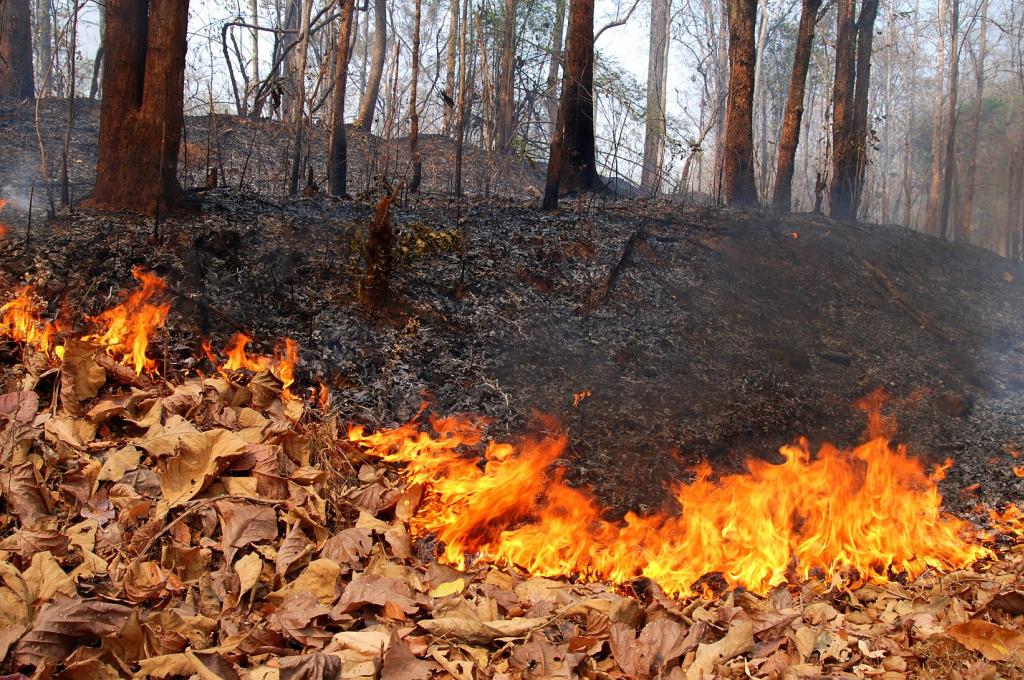
Forest fires have been raging across Northern Thailand for the past month, endangering the lives of animals and people. During the second half of March 2020, a considerable number of fire hotspots were detected within protected forest areas across eight provinces, with the highest concentration in Chiang Mai and Mae Hong Son provinces (GISTDA, 2020). The fires are attributed to man-made causes such as agricultural practices and clearing land for planting and hunting combined with weather-related factors. This has led to hazardous air pollution levels caused by a significant increase in PM2.5 across Thailand's northern region, posing serious health risks for people living in the surrounding communities.
SERVIR-Mekong is engaging with local universities and affected communities to raise awareness around air pollution. SERVIR-Mekong is working with Assistant Professor Dr. Nion Sirimongkonlertkun from Rajamangala University of Technology Lanna, Chiang Rai, to improve accuracy of the Chaingrai Hotspot Application, an application she developed to detect fire locations in Thailand, particularly in northern provinces. SERVIR-Mekong is supporting Dr. Sirimongkonlertkun to use new and higher-resolution NASA satellite data to update and expand the application across the country and the region
"Using fire hotspot detection from NASA satellites with higher resolution has been very helpful for firefighters to respond in a more timely manner," says Dr. Nion Sirimongkonlertkun.
SERVIR-Mekong also developed a new Air Quality Explorer tool that uses satellite-based fire hotspot detection technology to provide near real-time information on the location of fires and geographical extent of burned areas to monitor transboundary plumes. The tool combines the ground data provided by local government agencies with NASA’s satellite-derived air quality indices and fire hotspot data to determine the types of land cover affected by fires.
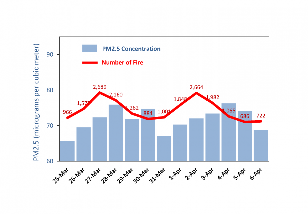
SERVIR-Mekong’s Air Quality Explorer tool was used alongside the fire hotspot data to investigate the relationship between the number of fire hotspots and their impact on the PM2.5 concentration. Figure 1 shows that the daily PM2.5 values follow the trend of the number of fire hotspots from March 25 to April 6, 2020, when forest fires ravaged many places in the Northern provinces.
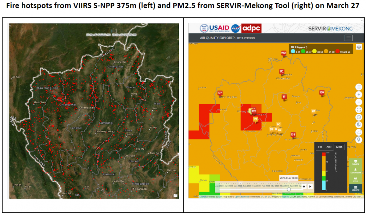
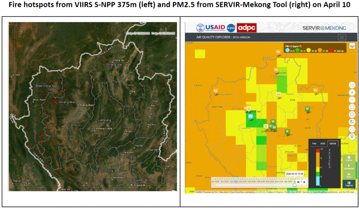
In Figure 2a and 2b, the fire hotspot locations are shown on the satellite image on the left, while the PM2.5 concentration is shown on a map on the right. The data suggests a strong positive correlation between the number of fires and the PM2.5 concentration. The significantly higher number of fire hotspots in Figure 2a, taken on March 27, seems to correspond to poor air quality, indicated by the very unhealthy (red) and unhealthy (orange) areas on the PM2.5 map (right image). On the other hand, Figure 2b, taken on April 10, has a considerably lower number of fire hotspots, which suggests a positive impact on the air quality, as indicated by the moderate (yellow) and satisfactory (green) areas on the PM2.5 map (right image).
The tool is still under development with ongoing collaboration between SERVIR-Mekong, Thailand’s Pollution Control Department and the Geo-Informatics and Space Technology Development Agency (GISTDA), adding in features including an advisory system for phone applications and real-time validation with hourly ground measurements. Once fully operational, SERVIR-Mekong will expand the outreach of this service regionally to assist with the monitoring of transboundary air pollution. The service can potentially support the ASEAN Agreement on Transboundary Haze Pollution. This will enable regional organizations such as the ASEAN Secretariat and national governments to use the tool to support policies and measures to prevent the spread of forest fires and agricultural burning, contributing to better sustainable landscape management.