
Knowledge Products

Spatially and temporally consistent vegetation structure time-series have great potential to improve the capacity for national land cover monitoring, to reduce latency and cost of international…
Land cover monitoring efforts are important for resource planning and ecosystem services in many countries. Collect Earth Online (CEO) is a new, free open source and user-friendly software tool for…
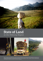
The Mekong region is in the midst of profound social and environmental change. Despite urbanization, the region remains predominantly rural with more than 60 percent of its population living in rural…
Multimedia
Special Reports
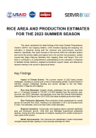
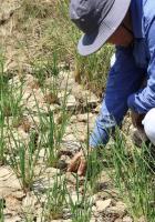
This report represents the latest findings of the Asian Disaster Preparedness Center's (ADPC) rice mapping initiative, which includes mapping and analyzing rice cultivation in Myanmar during both the…
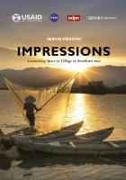
“Impressions” chronicles SERVIR-Mekong's journey from its launch until the present day. The book documents the program's achievements and learnings as SERVIR-Mekong looks to the future—using…
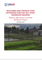
The study analyzes rice cultivation in Myanmar for the 2021 post-monsoon season, covering eight of the country's most significant rice-producing regions. The research provides a comprehensive…

Abstract:
Water resources support more than 60 million people in the Lower Mekong Basin (LMB) and are important for food security—especially rice production— and economic security. This study aims…
Regional
Land cover maps play an integral role in environment management. However, countries and institutes encounter many challenges with producing timely, efficient, and temporarily harmonized updates to…
Spatially and temporally consistent vegetation structure time-series have great potential to improve the capacity for national land cover monitoring, to reduce latency and cost of international…
Land cover monitoring efforts are important for resource planning and ecosystem services in many countries. Collect Earth Online (CEO) is a new, free open source and user-friendly software tool for…
The Mekong region is in the midst of profound social and environmental change. Despite urbanization, the region remains predominantly rural with more than 60 percent of its population living in rural…
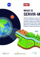
Implemented by the Asian Disaster Preparedness Center (ADPC), SERVIR-Mekong is funded by USAID in partnership with NASA. This infographic card provides an overview of the program.
A SERVIR-Mekong infographic: SERVIR-Mekong, funded by USAID, in partnership with NASA, uses a suite of publicly available data from space technology to create innovative solutions to development…
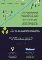
The Dam Inundation Mapping Tool: Millions of people in Southeast Asia rely on the Irrawady, Salween, Mekong and Red Rovers for fishers, agriculture, electricity, and drinking water. This infographic…
Language:
SERVIR-Mekong is a USAID-NASA partnership program designed to improve environmental management and resilience to climate change in the Lower Mekong Region through the increased application of…
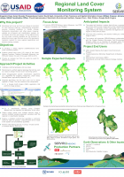
Monitoring land cover and land use change is important for land resource mapping, understanding ecosystem services including resilience to climate change, biodiversity conservation and other issues.…
Land cover maps are a critical component to make informed policy, development, planning, and resource management decisions. However, technical, capacity, and institutional challenges inhibit the…
The Mekong region is in the midst of profound social and environmental change. Despite urbanization, the region remains predominantly rural with more than 60 percent of its population living in rural…
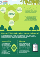
This fact sheet and infographic explains how SERVIR-Mekong's geospatial tool developed in collaboration with Vietnam’s Ministry of Agriculture and Rural Development (MARD) enables agencies under MARD…
Implemented by the Asian Disaster Preparedness Center (ADPC), SERVIR-Mekong is funded by USAID in partnership with NASA. This infographic card provides an overview of the program.
A SERVIR-Mekong infographic: SERVIR-Mekong, funded by USAID, in partnership with NASA, uses a suite of publicly available data from space technology to create innovative solutions to development…
The Dam Inundation Mapping Tool: Millions of people in Southeast Asia rely on the Irrawady, Salween, Mekong and Red Rovers for fishers, agriculture, electricity, and drinking water. This infographic…
Language:
SERVIR-Mekong is a USAID-NASA partnership program designed to improve environmental management and resilience to climate change in the Lower Mekong Region through the increased application of…
Monitoring land cover and land use change is important for land resource mapping, understanding ecosystem services including resilience to climate change, biodiversity conservation and other issues.…