Connecting Space to Village in Southeast Asia
SERVIR Southeast Asia
The SERVIR Southeast Asia (SERVIR SEA) project is a geospatial data-for-development initiative designed to meet the evolving needs of countries across the region. Implemented by ADPC, the project expands on the successes of the earlier SERVIR Mekong program by broadening geographic coverage and deepening regional impact. SERVIR SEA is continuing to build on its achievements to advance the use of Earth observation and geospatial technologies in support of disaster risk reduction and sustainable development.
The SERVIR SEA Project
The Earth is facing a range of environmental challenges that threaten lives and livelihoods across the globe, including floods, droughts, and changes in ecosystems. In the face of these challenges, one critical question emerged: How do we monitor the health of an entire planet, and how can we use that information to take effective action?
For over 50 years, humankind has relied on the vantage point of space to gather vital information. Earth-orbiting satellites and technological innovations have enabled scientists to observe the planet on a global scale, providing the data necessary to address these challenges more effectively.
The SERVIR Southeast Asia (SERVIR SEA) project plays a vital role in translating this space-based information into action. SERVIR SEA harnesses Earth observation technologies and open data to support sustainable development and build resilience across the region. Working with local, national and regional partners, SERVIR SEA focuses on using satellite data and geospatial tools to manage and reduce environmental risks. Its activities were aimed at four key objectives:
- Strengthening and institutionalizing the technical capacity of government decision-makers and civil society to use geospatial data in planning and communication;
- Improving the sharing and accessibility of tailored geospatial data and services;
- Developing high-quality, user-focused tools, models, and applications to address pressing development needs; and
- Establishing the SERVIR SEA hub as a recognized regional provider of geospatial information, analyses, and capacity building.
The project, implemented by the Asian Disaster Preparedness Center (ADPC), combines development goals with cutting-edge Earth science, ensuring countries in Southeast Asia can use satellite-based data to better prepare for natural hazards, and support evidence-based policymaking.
The SERVIR SEA project is committed to building on its achievements, sustaining and expanding the use of geospatial technologies to strengthen disaster risk reduction, promote regional collaboration, and empower local communities. The legacy of SERVIR SEA lives on in the tools developed, the capacities built, and the partnerships forged across Southeast Asia.
What We Do
In a changing environment, people often lack information needed to understand and solve local, national, and regional challenges. To address these challenges, we look to science and technology. Extraordinary work is being done in space to collect information about the Earth. SERVIR works to streamline access to data and imagery from satellites so analysts can integrate this information into tools and models that are accessible to those who need it most.
SERVIR SEA empowers decision-makers with tools, products, and services to act locally on critical issues such as disasters, agriculture, water, ecosystems, and land use. Leveraging advanced technology platforms and prioritizing a demand-driven approach, the program breaks new ground in using innovative approaches to help decision-makers in the Southeast Asia region better respond to changing conditions.
-
Private Sector Partnerships in Technology:
Google Earth Engine (GEE) provides free-access to a large warehouse of over 40 years of satellite imagery and the computational power needed to analyze those images. It also allows for custom algorithms to be written and applied using its warehouse of satellite imagery, thus revolutionizing the way applications of remote sensing are performed. SERVIR SEA continues to expand collaborative activities with GEE that relate to several priority tools, curriculum development and general capacity building. Esri provides SERVIR SEA and its partners with access to industry-standard GIS software and technical support. SERVIR SEA is pursuing a hybrid approach to on-premise and cloud-based GIS database management, provision of geospatial web services, and free-and-open access to geospatial data. Google and Esri are providing SERVIR SEA with expertise from their developers to help our scientists and end users leverage this technology for crucial decision making. To support targeted and on-demand imaging needs, DigitalGlobe augments existing Earth observation data provided for free by NASA and other space agencies. SERVIR SEA employs this relationship for specific and necessary product validation. -
Technical Assistance Request Mechanism:
As a demand-driven project, SERVIR SEA has taken great effort to ensure that initiatives meet the ongoing needs of the region in a way that is malleable to and reflective of a changing environment. A key strategic mechanism to meet this demand-driven approach is our technical service-request mechanism. This can be accessed on our website here and allows anyone to submit a request for technical assistance (e.g. for data needs, tool requests, etc.). Our team will align these requests with the mandate of SERVIR SEA and other existing initiatives to prioritize and address these demands on an ongoing basis. -
University Partner Network:
SERVIR SEA has set up a network of focal points from universities in the region consisting of senior representatives and geospatial academics. The aim of this network is to strengthen in-country end user engagement, work towards joint research objectives, and help develop relevant curriculum and courses. These will all contribute to the program’s vision for long-term sustainability in the region. Currently, SERVIR SEA engages five key partner universities - Mandalay Technological University, Myanmar; Naresuan University, Thailand; National University of Laos; Royal University of Phnom Penh, Cambodia; and Vietnam National University-University of Science; however, this network is anticipated to grow as the program secures new partnerships.
Themes
SERVIR-SEA service areas

Agriculture and Food Security
The food security thematic service area includes agriculture, rangeland management and pastoralism, and fisheries and aquaculture. Key topics include linking agricultural productivity assessments, crop yield models, and use of long-term environmental scenarios for assessing impacts. SERVIR SEA focuses on generating seasonal predictions of crop yield, assessments of interannual to decadal changes on crop yields, and potential adaptation tools to monitor and/or mitigate the impacts on agriculture, rangeland management, and fisheries.

Land Cover, Land Use Change and Ecosystems
The land cover, land use and ecosystems thematic service area focuses on sustainable landscapes through natural capital accounting and ecosystem services. Ecosystem services are critically dependent on natural capital such as the quality of soils, organic and nutrient contents, topography, rainfall, and land cover among other factors. SERVIR SEA is working on a regional land cover map. Another key consideration is resilient agriculture and development. SERVIR SEA aligns closely with partner activities to assist countries in monitoring their forest and terrestrial carbon.

Water Resources and Disasters
The water resources and disasters thematic service area includes water quantity (including groundwater), sediment transport, and water quality. SERVIR SEA aims to address improved estimation and predictability of water resources for integrated water management in the Southeast ASIA Region. Key topics include water quantity, including estimations for water allocation; the food-water-energy nexus; and disaster investigations including floods, droughts, and rainfall-induced landslides. SERVIR SEA co-develops tools that empower decision-makers to make informed decisions to create and/or implement adaptation strategies.

Air Pollution and Health
The air pollution and health thematic service area uses geospatial technology to monitor air quality throughout the region. SERVIR SEA works to provide data on a variety of atmospheric pollutants, including particulate matter and aerosols, to assist public health officials and decision-makers. By integrating satellite observations with ground-based measurements and models, the program helps to track transboundary haze, identify pollution sources, and provide actionable information for improving air quality and protecting public health.
Decision Support Tools
These high quality user-tailored decision support tools and applications have been developed to address on-the-ground issues, empowering decision-makers to act locally on challenges such as disasters, agriculture, water management, ecosystem protection and land use.
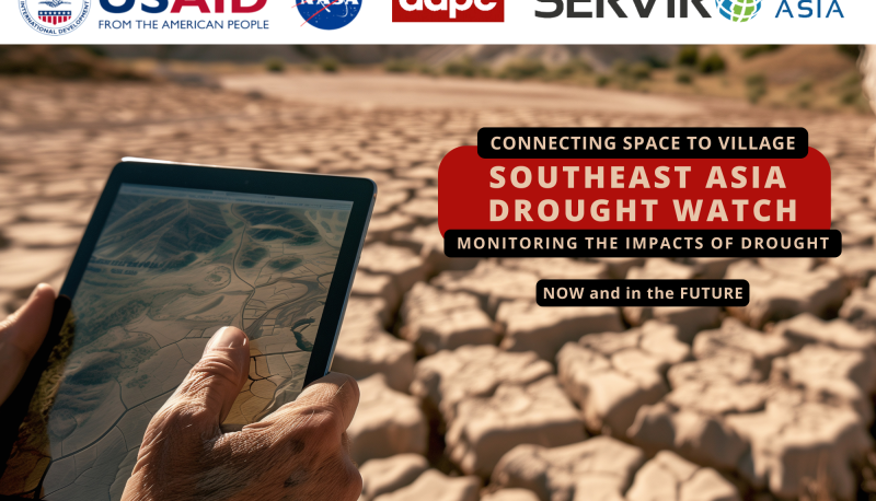
Southeast Asia Drought Watch (SEADW)
Droughts in Southeast Asia negatively impact ecosystem services, food and water security, and biodiversity. Further highlighting the need for improved governance and decision-making in virtually all sectors.
More...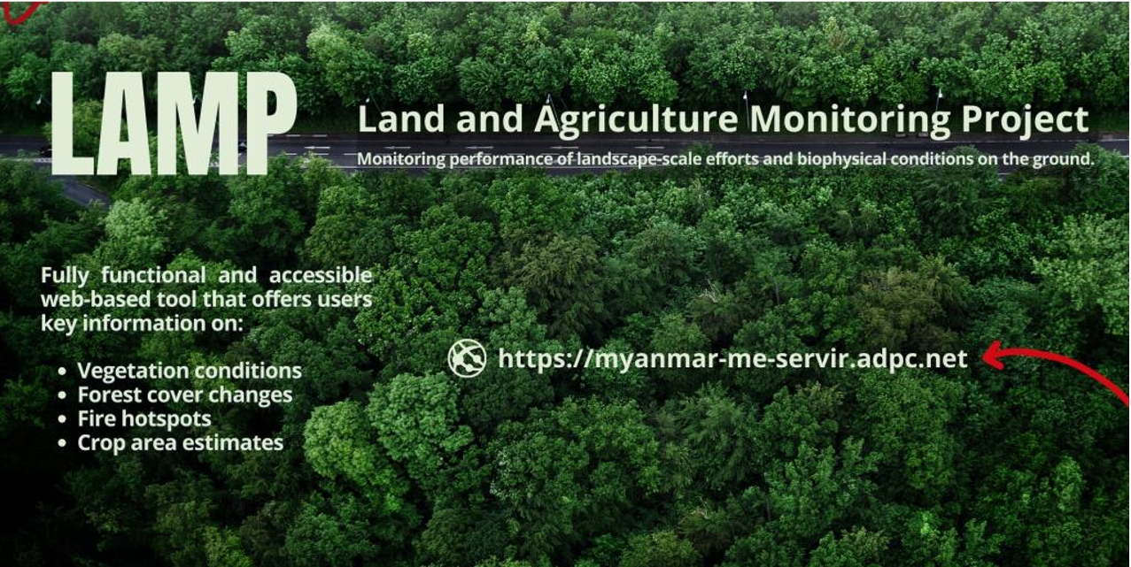
Land and Agriculture Monitoring Project (LAMP)
SERVIR Southeast Asia developed the Land and Agriculture Monitoring Project (LAMP) tool in response to a need expressed by stakeholders, who require insight and reports on the effectiveness of biodiversity and…
More...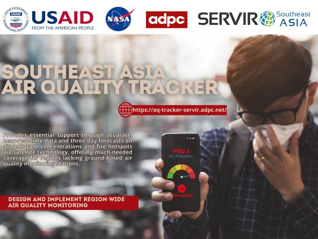
Southeast Asia Air Quality Tracker
Air quality is becoming a critical challenge across Southeast Asia, with the World Health Organization estimating that 2 million of the 7 million global deaths from air pollution exposure occur in the region.
More...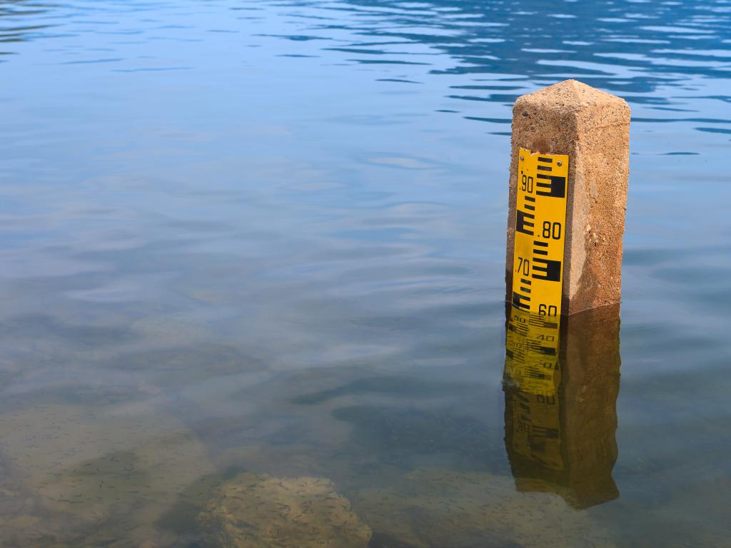
Satellite Radar-derived Virtual Rain and Stream Gauge Data Service
This service provides near real-time rainfall and stream height data from publicly available satellite measurements by creation of a virtual network of rain gauges and stream gauges at points widely distributed over the…
More...
Regional Land Cover Monitoring System
This system guides users in applying peer-reviewed methods and cloud computing power to produce a wide variety of high-quality land cover information products that can be updated regularly and consistently.
More...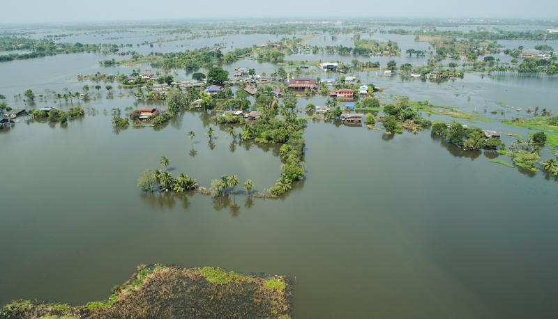
Historical Flood Analysis Tool
Currently, there is lack of systematic flood risk analysis through collection of local knowledge in order to inform emergency planning, which although critical, takes significant resources and can introduce bias and human…
More...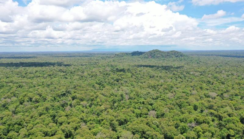
Biophysical M&E Dashboard
The Biophysical M&E Dashboard supports the monitoring and management of large-scale sustainable landscape projects by using satellite data to determine landscape conditions before and after project intervention...
More...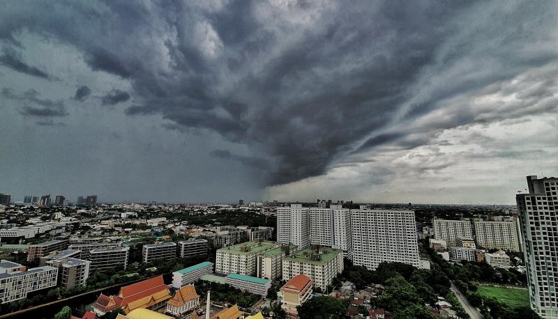
Rainstorm Tracker
Rainstorm Tracker tool is an operational storm analyzer developed to monitor and alert authorities about the severity of rainstorm events over the Lower Mekong Basin in near-real-time. This system employs a 4D object-…
More...
Cambodia Protected Area Alerts System
Cambodia Protected Area Alerts System monitors near real-time forest changes and external threats including deforestation, forest fires and floods within the PreyLang Wildlife Sanctuary, a protected area in Cambodia. is a…
More...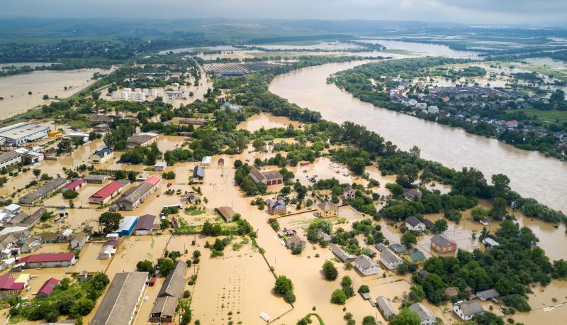
The Hydrologic Remote Sensing Analysis for Floods (HYDRAFloods)
A publicly available, web-based, near real-time flood monitoring tool designed to improve flood monitoring systems using freely available satellite remote sensing data, HYDRAFloods uses Artificial Intelligence (AI) to…
More...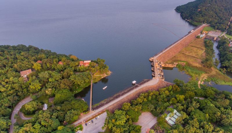
Reservoir Assessment Tool for Lower Mekong Basin (RAT-Mekong)
RAT-Mekong is a web application for forecasting hydrologic impacts and operating patterns of existing and planned reservoirs in the Lower Mekong Region.
More...
Mekong X-Ray
The Mekong X-Ray is an open-source, web-based decision support tool for multidimensional flood vulnerability assessment, including mapping physical, social, economic, and environmental dimensions to support flood risk…
More...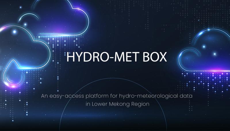
HYDROMET-BOX
HYDRO-MET Box is an easy-access platform for hydro-meteorological data in Lower Mekong Region
More...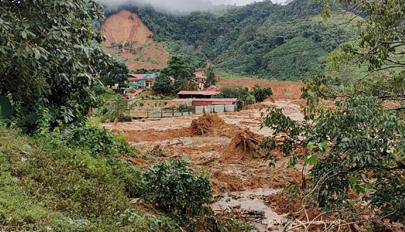
Landslide Hazard Assessment for Situational Awareness for Lower Mekong Region (LHASA-Mekong)
The LHASA-Mekong incorporates Earth Observation (EO)-based products and artificial intelligence (AI) models in a flexible decision support system to quantify landslide hazard and exposure over the Lower Mekong Region
More...Contact
ASIAN DISASTER PREPAREDNESS CENTER (ADPC)
SM Tower, 24th Floor, 979/69 Paholyothin Road, Samsen Nai Phayathai, Bangkok 10400 Thailand
BTS Skytrain: Sanam Pao, Exit 1
Office tel: +66 2 298 0681-92
Dr. Peeranan Towashiraporn
Email: peeranan@adpc.net