
Dancing rivers of Myanmar – mapping moves from space
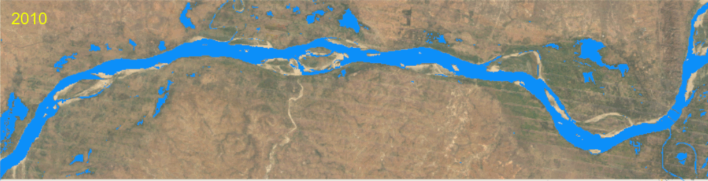
Changes in river morphology including floods, erosion, and landslides are affecting ecosystem habitats and the lives and livelihoods of communities living along Myanmar’s rivers. SERVIR-Mekong is using satellite-based monitoring tools to support Myanmar agencies and communities to manage the risks better.
Last year in Myanmar, floods resulted in 31 deaths and displaced over 300,000 people because official warnings came too late.To help prevent such crises, SERVIR-Mekong and the Stockholm Environment Institute (SEI) are developing a seasonal river morphological monitoring and warning system called Dancing Rivers to improve flood forecasting in Myanmar.
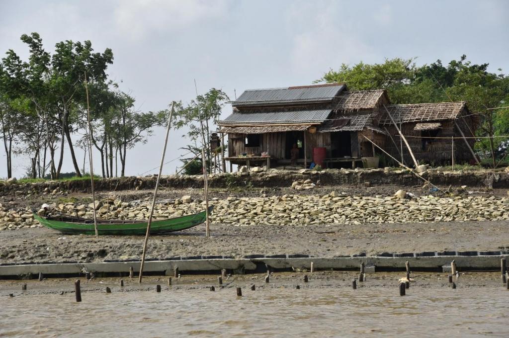
Recurrent riverbank erosion and collapse are becoming frequent, particularly during Myanmar’s monsoon season. This forces people to relocate their homes and lose agricultural livelihoods. In recent years, increased quarrying activities have emerged as an additional drivers of relocation and livelihood loss. The choice between staying in one place or relocating permanently elsewhere is often only a question of a few meters for many communities living along the country’s rivers. These temporary but frequent relocations expose communities to a host of difficulties, including water shortages, lack of fertile farmland, and loss of meagre savings as people are forced to rebuild their lives from scratch.
The Directorate of Water Resources and Improvement of River Systems (DWIR), Myanmar’s national governmental agency responsible for managing river systems, faces a daunting challenge to monitor river morphological change over several thousand kilometres of river in the country – a challenge that requires extensive human, financial, and technical resources.
How can we improve the monitoring mechanism and build the warning system?
To address this river management knowledge gap, SERVIR-Mekong, a joint initiative between the United States Agency for International Development (USAID) and the National Aeronautics and Space Administration (NASA), is developing a seasonal river morphological monitoring and warning system called Dancing Rivers. The SERVIR-Mekong consortium, which includes the Asian Disaster Preparedness Center and SEI, is co-developing this service with DWIR to ensure an adequate knowledge base to plan and make informed decisions on riverbank protection at large spatio-temporal scales.
To capture user needs and feed into the overall service planning, the SERVIR-Mekong project team conducted a needs assessment workshop in Yangon on May 16, 2019, with national and regional DWIR officials, multiple government agencies, universities, and national and international NGOs.
Written by Karthikeyan Matheswaran, Thanapon Piman, and Rajesh Daniel of SEI. Click here to access the full article.