Improving Drought Resilience and Water Resource Management in Vietnam

From 2014 to 2016, Vietnam experienced its worst drought in 90 years, with 52 out of the 63 provinces affected. This event and subsequent disasters emphasized the Vietnamese government’s need for a reliable system that can provide forecast information about rainfall and drought. To address this challenge, SERVIR-Mekong worked with Vietnam’s Ministry of Agriculture and Rural Development (MARD) to develop a geospatial tool which enables agencies under MARD to prepare for and respond to droughts more effectively.
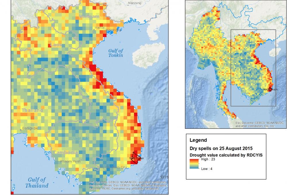
As a part of this effort, SERVIR-Mekong, in collaboration with the Vietnam Academy for Water Resources (VAWR), calibrated the Regional Hydrologic Extremes Assessment System (RHEAS) model for drought forecasting in Ninh Thuan Province. VAWR is using information such as drought indices, rainfall, and soil moisture, along with maps produced through the Regional Drought and Crop Yield Information System to estimate water availability and produce the monthly water resources bulletin for Ninh Thuan Province.
“The tool is effective for decision makers at the provincial level in their development of water resource management, irrigation operation to respond to droughts and agriculture planning,” says Dr. Ha Hai Duong, Chief of Department of Water Resources and Climate Change, Institute for Water and Environment (IWE) at VAWR.
MARD’s Water Resource Directorate and Irrigation Management Companies also benefit from the monthly bulletin to support irrigation operation in the province. Since 2016, SERVIR-Mekong has conducted a series of trainings on RHEAS modeling and Google Earth Engine for application of water resource management for VAWR and other partners in Vietnam. These and the development of RHEAS have been done in collaboration with SERVIR Applied Sciences Team members from the NASA Jet Propulsion Laboratory and University of Massachusetts at Amherst.
In addition, SERVIR-Mekong small grant recipients Nguyen Xuan Lam and Bui Tuan Trung from the IWE used satellite data to strengthen the capacity of reservoir operation and management for increasing resilience to drought and ensuring water and food security for Ninh Thuan province. They were also co-trainers in one of the Google Earth Engine trainings. All of these SERVIR-Mekong efforts have created change in existing practices.
“There is increased involvement of stakeholders in water resources planning. This resulted in better understanding of the drought situation in Ninh Thuan province,” said Nguyen Xuan Lam. “IWE's network was expanded through engagement with SERVIR and the tool could be considered as co-product which will have a positive impact in disaster preparedness efforts in Vietnam.”
This web-based system uses GIS technology and is free for use by everyone, including provincial, district and community levels. The system has been accepted by Ninh Thuan's irrigation management company a state agency who controls most of the water resources system in Ninh Thuan. The management company in Ninh Thuan province uses and constantly updates the system for the water irrigation operation in the province. This has improved the company’s ability to suggest irrigation areas for different types of crops, resulting in improved crop management.


