Gender
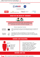
A look at how gender-related issues can be incorporated into Geographic Information Systems (GIS) to support better decision making for climate and disaster risk management and natural resource…
GIS & Geospatial Data
What is SERVIR? This infographic highlights the key objectives and services the SERVIR Hub Network offers.
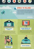
SERVIR in Action Infographic highlights how SERVIR tools and services can help climate and disaster resilience and sustainable development.
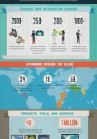
SERVIR By the Numbers Infographic highlights some key figures and achievements made by the SERVIR Hub Network.
In Myanmar, changes in river morphology including floods, erosion, and landslides are affecting ecosystem habitats and the lives and livelihoods of communities living along rivers. SERVIR-Mekong is…
Land Cover / Land Use & Ecosystems
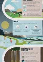
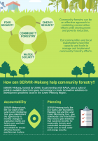
A SERVIR-Mekong infographic: SERVIR-Mekong, funded by USAID, in partnership with NASA, uses a suite of publicly available data from space technology to create innovative solutions to development…
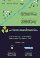
The Dam Inundation Mapping Tool: Millions of people in Southeast Asia rely on the Irrawady, Salween, Mekong and Red Rovers for fishers, agriculture, electricity, and drinking water. This infographic…
Water Resources & Disasters
The Dam Inundation Mapping Tool: Millions of people in Southeast Asia rely on the Irrawady, Salween, Mekong and Red Rovers for fishers, agriculture, electricity, and drinking water. This infographic…
In Myanmar, changes in river morphology including floods, erosion, and landslides are affecting ecosystem habitats and the lives and livelihoods of communities living along rivers. SERVIR-Mekong is…
Myanmar
In Myanmar, changes in river morphology including floods, erosion, and landslides are affecting ecosystem habitats and the lives and livelihoods of communities living along rivers. SERVIR-Mekong is…
Regional
A SERVIR-Mekong infographic: SERVIR-Mekong, funded by USAID, in partnership with NASA, uses a suite of publicly available data from space technology to create innovative solutions to development…
The Dam Inundation Mapping Tool: Millions of people in Southeast Asia rely on the Irrawady, Salween, Mekong and Red Rovers for fishers, agriculture, electricity, and drinking water. This infographic…
A look at how gender-related issues can be incorporated into Geographic Information Systems (GIS) to support better decision making for climate and disaster risk management and natural resource…
What is SERVIR? This infographic highlights the key objectives and services the SERVIR Hub Network offers.
SERVIR By the Numbers Infographic highlights some key figures and achievements made by the SERVIR Hub Network.
SERVIR in Action Infographic highlights how SERVIR tools and services can help climate and disaster resilience and sustainable development.
In Myanmar, changes in river morphology including floods, erosion, and landslides are affecting ecosystem habitats and the lives and livelihoods of communities living along rivers. SERVIR-Mekong…
A SERVIR-Mekong infographic: SERVIR-Mekong, funded by USAID, in partnership with NASA, uses a suite of publicly available data from space technology to create innovative solutions to development…
The Dam Inundation Mapping Tool: Millions of people in Southeast Asia rely on the Irrawady, Salween, Mekong and Red Rovers for fishers, agriculture, electricity, and drinking water. This infographic…
A look at how gender-related issues can be incorporated into Geographic Information Systems (GIS) to support better decision making for climate and disaster risk management and natural resource…
What is SERVIR? This infographic highlights the key objectives and services the SERVIR Hub Network offers.
SERVIR By the Numbers Infographic highlights some key figures and achievements made by the SERVIR Hub Network.
SERVIR in Action Infographic highlights how SERVIR tools and services can help climate and disaster resilience and sustainable development.


