
Brochures, Fact Sheets and Posters
SERVIR-MEKONG
The SERVIR-Mekong activity uses publicly available satellite technologies to support regional institutions, governments, and citizens to address climate-related challenges such as…
The fact sheet and infographic explains SERVIR-Mekong's collaboration with Myanmar's Department of Disaster Management under the Ministry of Social Welfare Relief & Resettlement utilizes…
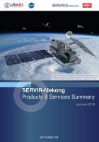
Implemented by the Asian Disaster Preparedness Center (ADPC), SERVIR-Mekong is funded by USAID in partnership with NASA. This infographic card provides an overview of the program.
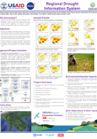
Why this Project?
Droughts in the Lower Mekong Region negatively impact ecosystem services, food and water security and biodiversity. These impacts are exacerbated by climate change, further…
Language:
SERVIR-Mekong is a USAID-NASA partnership program designed to improve environmental management and resilience to climate change in the Lower Mekong Region through the increased application of…
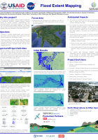
Why this Project?
The Lower Mekong Basin is subject to extremes in streamflow conditions, including frequent flooding during the annual monsoon. Understanding and chronicling historic and current…
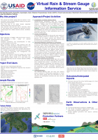
Rain and stream gauge data are sparse in time and space, which hampers decision making on long term planning and development. In addition, river flow data is not widely shared, especially…
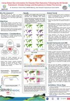
Future disruptions to fire activity will threaten ecosystems and human well-being throughout the world, yet there are few fire projections at global scales and almost none from a broad range of…
Knowledge Products
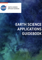
The Earth Science Applications Guidebook is a web-based, multimedia product that synthesizes best practices and lessons learned on the use of Earth science information for decision-making. It is also…
Multimedia
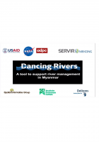
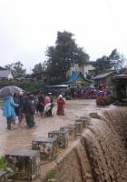
In Myanmar, changes in river morphology including floods, erosion, and landslides are affecting ecosystem habitats and the lives and livelihoods of communities living along rivers. SERVIR-Mekong is…
Cambodia
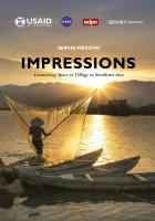
“Impressions” chronicles SERVIR-Mekong's journey from its launch until the present day. The book documents the program's achievements and learnings as SERVIR-Mekong looks to the future—using…
Laos
“Impressions” chronicles SERVIR-Mekong's journey from its launch until the present day. The book documents the program's achievements and learnings as SERVIR-Mekong looks to the future—using…
Myanmar
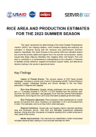
This report represents the latest findings of the Asian Disaster Preparedness Center's (ADPC) rice mapping initiative, which includes mapping and analyzing rice cultivation in Myanmar during both the…
“Impressions” chronicles SERVIR-Mekong's journey from its launch until the present day. The book documents the program's achievements and learnings as SERVIR-Mekong looks to the future—using…
In Myanmar, changes in river morphology including floods, erosion, and landslides are affecting ecosystem habitats and the lives and livelihoods of communities living along rivers. SERVIR-Mekong is…
The fact sheet and infographic explains SERVIR-Mekong's collaboration with Myanmar's Department of Disaster Management under the Ministry of Social Welfare Relief & Resettlement utilizes…
Regional
“Impressions” chronicles SERVIR-Mekong's journey from its launch until the present day. The book documents the program's achievements and learnings as SERVIR-Mekong looks to the future—using…
The Earth Science Applications Guidebook is a web-based, multimedia product that synthesizes best practices and lessons learned on the use of Earth science information for decision-making. It is also…
Implemented by the Asian Disaster Preparedness Center (ADPC), SERVIR-Mekong is funded by USAID in partnership with NASA. This infographic card provides an overview of the program.
This report represents the latest findings of the Asian Disaster Preparedness Center's (ADPC) rice mapping initiative, which includes mapping and analyzing rice cultivation in Myanmar during both the…
“Impressions” chronicles SERVIR-Mekong's journey from its launch until the present day. The book documents the program's achievements and learnings as SERVIR-Mekong looks to the future—using…
The Earth Science Applications Guidebook is a web-based, multimedia product that synthesizes best practices and lessons learned on the use of Earth science information for decision-making. It is also…
In Myanmar, changes in river morphology including floods, erosion, and landslides are affecting ecosystem habitats and the lives and livelihoods of communities living along rivers. SERVIR-Mekong is…
The fact sheet and infographic explains SERVIR-Mekong's collaboration with Myanmar's Department of Disaster Management under the Ministry of Social Welfare Relief & Resettlement utilizes…
Implemented by the Asian Disaster Preparedness Center (ADPC), SERVIR-Mekong is funded by USAID in partnership with NASA. This infographic card provides an overview of the program.

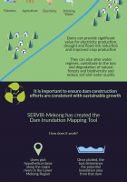
The Dam Inundation Mapping Tool: Millions of people in Southeast Asia rely on the Irrawady, Salween, Mekong and Red Rovers for fishers, agriculture, electricity, and drinking water. This infographic…
Why this Project?
Droughts in the Lower Mekong Region negatively impact ecosystem services, food and water security and biodiversity. These impacts are exacerbated by climate change, further…