
Developers Improve Land Use Monitoring from Space
Following the launch of the Regional Land Cover Monitoring System (RLCMS) in 2018, developers are releasing an upgraded version resulting from a collaborative effort between SERVIR-Mekong and SERVIR Hindu Kush Himalaya.
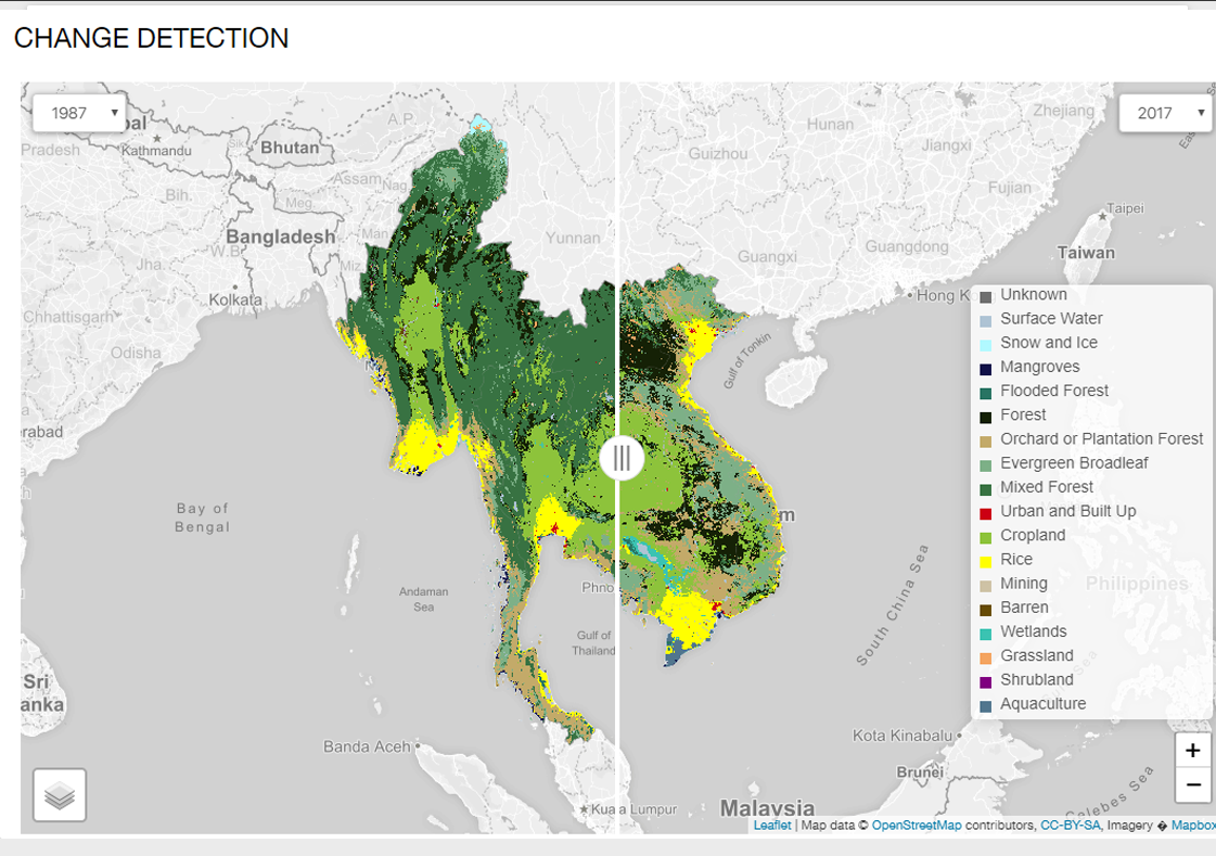
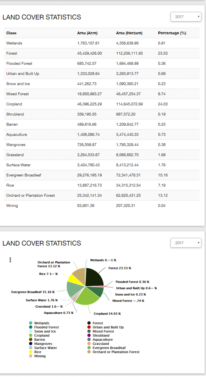
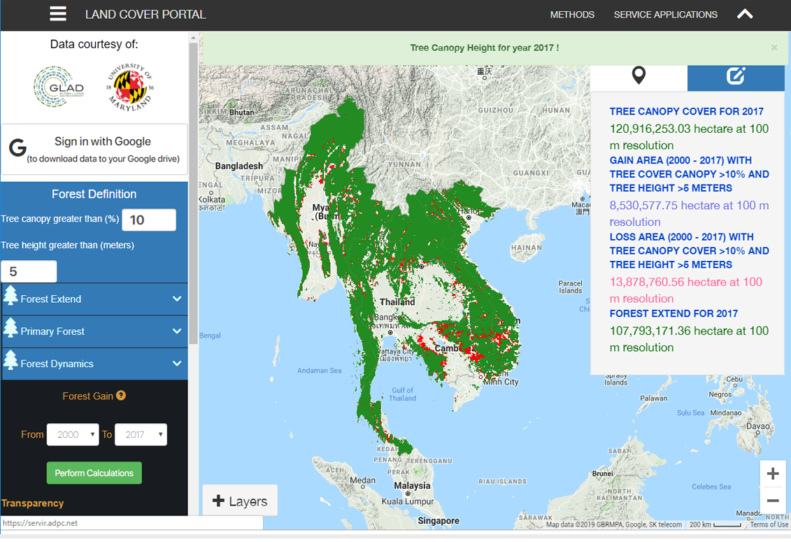
In this new version users will experience improvements to accurately calculate various land types and improvements to data inputs for better LANDSAT models; an expanded time span will be applied so users can access land cover data from 1987 through 2017, where previous versions only extended to 2000.
This initiative is part of the SERVIR program funded by the United States Agency for International Development (USAID) in partnership with the National Aeronautics and Space Administration (NASA). SERVIR supports regional hubs in South and Southeast Asia, Africa and South America. For the Southeast Asia region, SERVIR-Mekong harnesses publicly available satellite imagery and technologies to support government and other stakeholders in the Lower Mekong region in addressing development issues such disaster impact and environmental changes. Asian Disaster Preparedness Center (ADPC), an intergovernmental organization dedicated to strengthening disaster resilience in Asia, is the prime implementer of SERVIR-Mekong, and is supported by three other consortium partners: Spatial Informatics Group (SIG), Stockholm Environment Institute (SEI) and Deltares.
SERVIR Hindu Kush Himalaya (SERVIR-HKH) is implemented by the International Centre for Integrated Mountain Development (ICIMOD) under its Mountain Environment Regional Information System (MENRIS) Regional Programme. Prioritizing activities in Afghanistan, Bangladesh, Myanmar, Nepal and Pakistan, SERVIR-HKH caters to the specific needs of ICIMOD’s regional member countries in addressing different aspects of environmental degradation and climate change impacts.
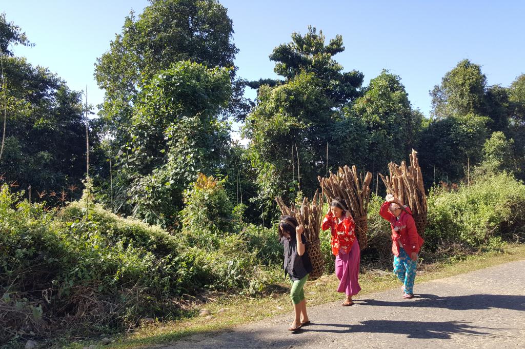
SERVIR-Mekong is collaborating with the Forest Department of Myanmar to build a national land cover monitoring system, which can generate data to calculate greenhouse gas emissions (GHG) to fulfill Myanmar’s requirement to the Paris Agreement Convention to the Conference of Parties. This agreement requires parties to the Conventions to submit a detailed GHG inventory to the United Nations Framework Convention on Climate Change.
“Myanmar developed good quality time series national land cover mapping from 1990 to 2017 for the first time through partnership with SERVIR-Mekong,” said Dr. Myat Su Mon, Deputy Director of Myanmar’s Forest Department, Ministry of Natural Resources and Environmental Conservation.
In addition, SERVIR-Mekong collaborated with SilvaCarbon, to build capacity of Vietnam’s Forest Inventory and Planning Institute (FIPI) in utilizing the RLCMS approach and Google Earth Engine for improving forest monitoring in Vietnam.
“The cloud based computing and machine learning approach of the RLCMS from SERVIR-Mekong is an innovative approach in forest mapping. We have learned a lot from you and are going to integrate it in our fifth forest monitoring cycle project,” said Pham Ngoc Hai, an officer at FIPI’s Training and International Cooperation Division.
SERVIR-Mekong continues to work with government agencies throughout the region to further strengthen local capacity in further enhancing the system and utilization for improved planning and monitoring of natural resources. There are plans to extend the application of RLCMS beyond this region, to other areas such as Latin America and Africa through the SERVIR network.