
The Earth is witnessing a warming of the climate system that is unprecedented. This warming is causing sea levels to rise, floods and droughts to occur more frequently, and ecosystems to change dramatically, thus threatening livelihoods. The question now, is, what can we do? How do you track the health of an entire planet? How can we improve it? Like an afflicted patient, we start with the obvious - how do things look? What are the symptoms? What’s the temperature? These are good starting points; however, our home planet is much more complex than that, and there are many high-tech ways to determine its condition more precisely. For over 50 years, since the first weather satellite was launched, human beings have been taking advantage of the high ground of space to understand what is happening on our planet. Earth-orbiting satellites and other technological advances have enabled scientists to see the big picture, collecting many different types of information about our planet and its climate on a global scale. This body of data, collected over many years, has the potential to unlock the solutions to better resilience to climate change.
 Through a unique partnership between the U.S. Agency for International Development (USAID) and the U.S. National Aeronautics and Space Agency (NASA), SERVIR SEA is harnessing such space technology and open data to help address development challenges related to a changing climate.
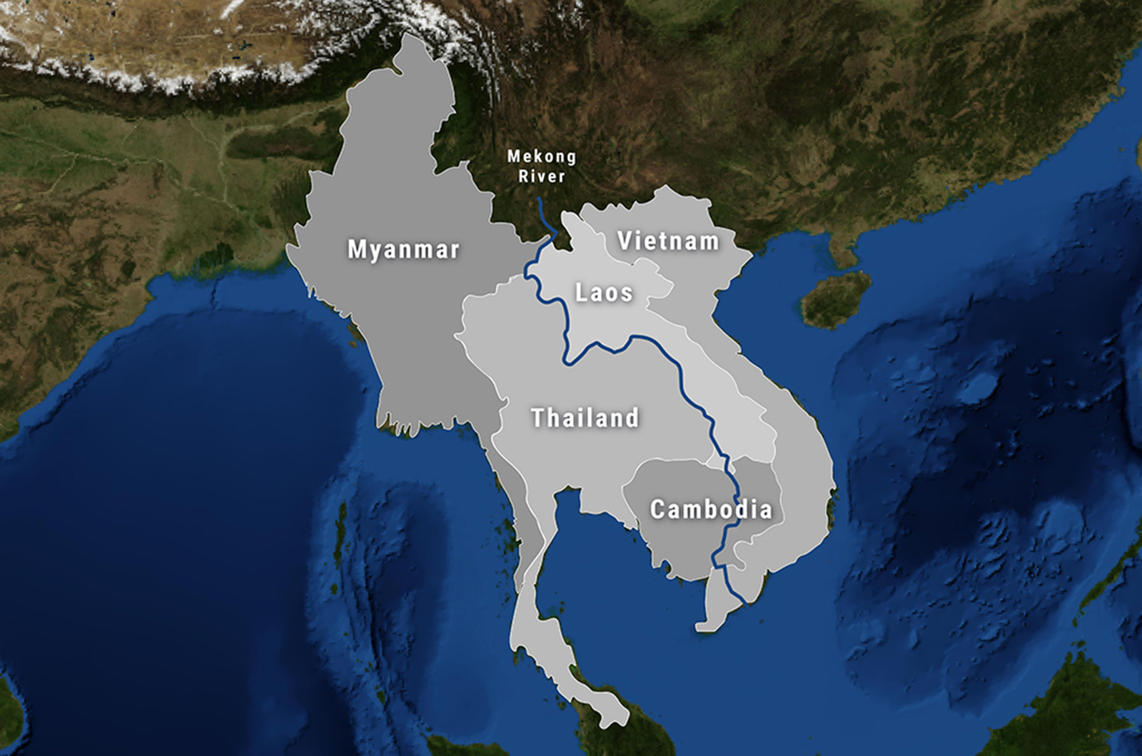
SERVIR SEA works in partnership with leading regional organizations to help the seven countries in the Southeast ASIA Region use information provided by Earth observing satellites and geospatial technologies to manage climate risks. The region includes Cambodia, Indonesia, Lao PDR, Myanmar (Burma), Philippines, Thailand and Vietnam.
SERVIR SEA’s activities are designed to meet the following objectives
- Build and institutionalize the technical capacity of government decision makers and key civil society groups to integrate geospatial information into their decision-making, planning, and communication.
- Improve the sharing of user-tailored geospatial data, products and services.
- Develop new high quality user-tailored data, tools, applications, and models to address on-the ground priorities.
- SERVIR SEA hub strengthened as a regional provider of geospatial data, analyses, and capacity building services
The Asian Disaster Preparedness Center (ADPC), a recognized leader in strengthening disaster resilience in Asia, is the prime implementer for SERVIR SEA.