
Laos dam collapse and flooding: View from Space

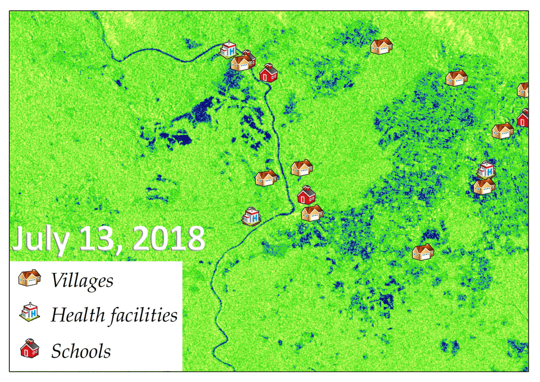
The collapse of the Xe Namnoy Xe Pian Dam in Sanamxay district, Attapeu province of Lao PDR on the night of July 23 flooded villages and left thousands homeless.
SERVIR-Mekong, in coordination with the U.S. National Aeronautics and Space Administration (NASA) Disasters Program, and the Japan Aerospace Exploration Agency (JAXA) through the Sentinel Asia mechanism, processed satellite imagery to estimate the extent of the flooded areas, particularly along the Xe Pian River and village of Sanamxai along the Xe Khong River in Attapeu Province.
Since the dam failure on July 23, cloudy skies have prevented clear views of the affected area from many of the satellites that could have been useful. A synthetic aperture radar (SAR) sensor on board the European Space Agency’s satellite Sentinel-1A and JAXA’s ALOS-2 offers cloud-penetrating technology, providing views of the flood extent on the ground.
With repeating observations from the satellites, it was possible to map progression of the flood over several days, allowing emergency response practitioners to use the information to understand the situation and plan their actions on the ground effectively.
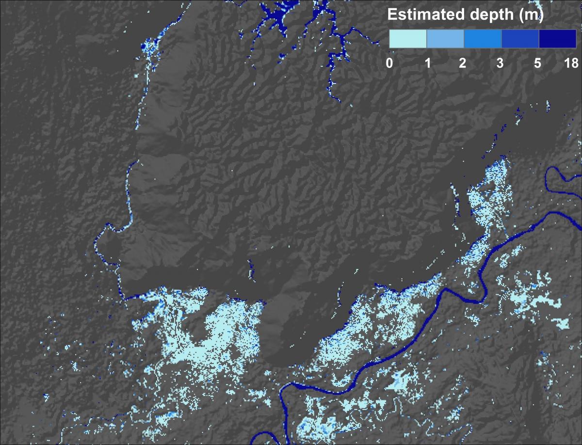
Produced by Kittiphong Phongsapan/ADPC
SERVIR-Mekong partners used the derived satellite data to assess the potential socio-economic impact of the flood. Estimates of flood inundation depths were derived using flood maps and elevations from the MERIT DEM (an improvement on the global Shuttle Radar Topography Mission (SRTM) data).
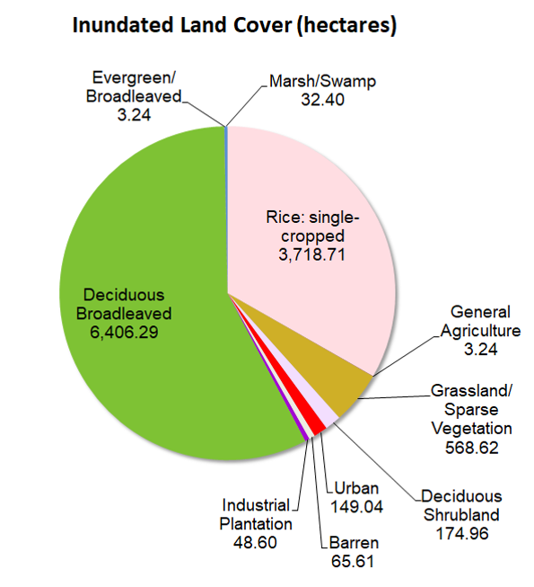
The team combined flood depths with socioeconomic data to assess potential damages from the flood event. Infrastructure such as the location of buildings and roads were obtained from OpenStreetMap, and population density maps were obtained from WorldPop to determine numbers of affected people. Damages to land cover were assessed using a land cover/land use map produced by the Mekong River Commission. Regionally-derived depth-damage curves were applied to land cover classes to produce provisional damage estimates:
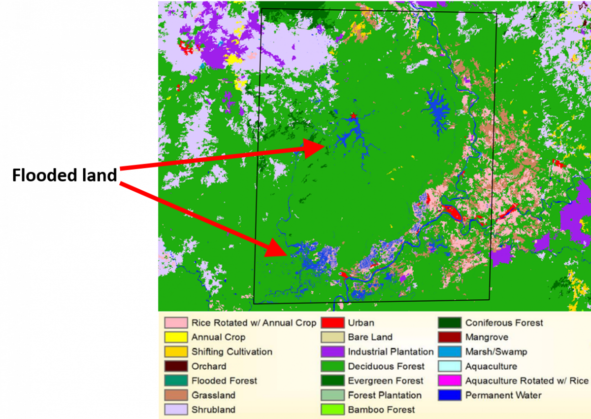
Source: Land Cover Map of the Lower Mekong Basin, Mekong River Commission (2016)
Flooding continues to hamper development in the Lower Mekong. SERVIR-Mekong is developing a near real-time flood monitoring tool to allow decision makers to have instant access to information on flood inundation areas. Timely information will help countries in taking early actions to minimize further impact on those who are affected and expedite recovery, hence lessening the overall consequence of flood to the economy.