
SERVIR-Mekong’s Geospatial Technology Helps to Combat Forest Fires in Chiang Rai, Thailand
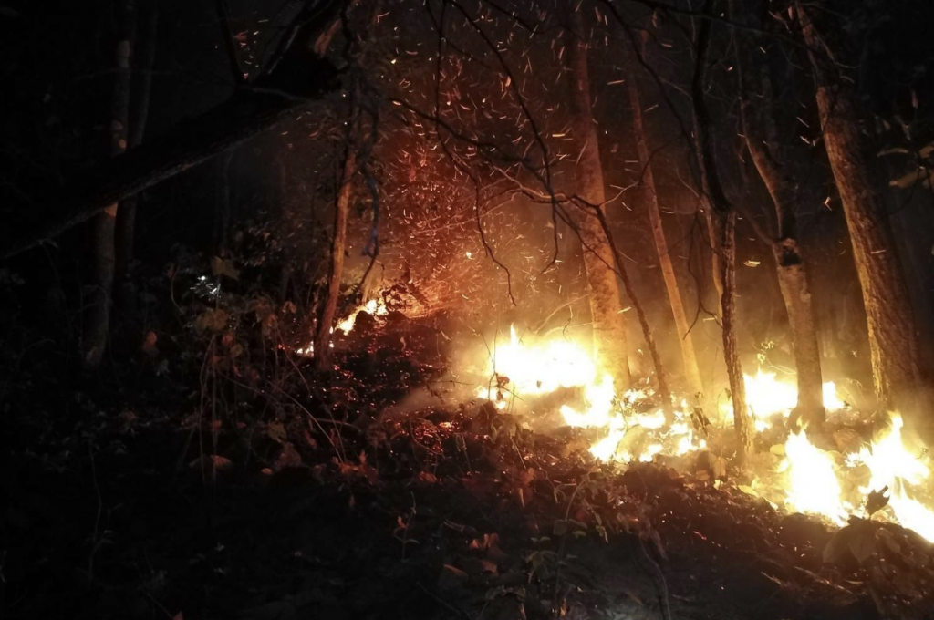
March marked the onset of the dry and hot season in Thailand. Dry vegetation coupled with small man-made fires have often resulted in forest fires getting out of control. This year is no different. The fire season has started in Chiang Rai province causing a deterioration in air quality in the Northern provinces of Thailand.
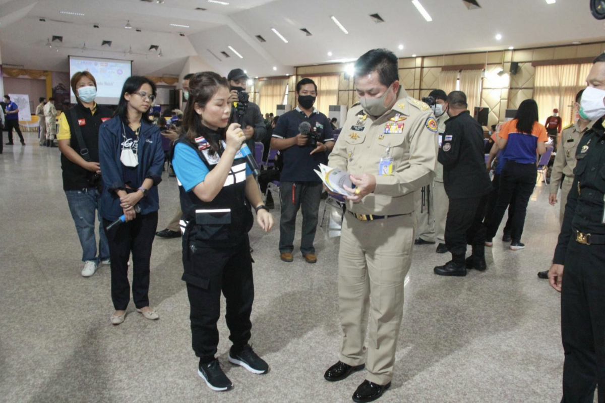
A notable change this year is the use of geospatial data in monitoring fire hotspots and targeted interventions to put out the fires. This work is championed by Dr. Nion Sirimongkonlertkul and her team from Rajamangala University of Technology, Thailand in collaboration with SERVIR-Mekong, a partnership between the U.S. Agency for International Development (USAID) and the U.S. National Aeronautics and Space Administration (NASA).
Agricultural burning and forest fires, including transboundary haze, have contributed to high levels of pollution. Forest fires release particulate matter (PM) into the atmosphere. PM is a common proxy indicator of air pollution consisting of sulfates, nitrates, ammonia, sodium chloride, black carbon, mineral dust and water. PM2.5 refers to microscopic particles with a diameter of 2.5 microns or less - that is 30 times smaller than the diameter of the human hair.
Forest fires have a huge impact on the health of communities living in adjoining areas, and beyond. PM2.5 released during forest fires and agricultural burning can penetrate the lung barrier and enter the blood system. Chronic exposure to PM2.5 increases the risk of developing cardiovascular and respiratory diseases, as well as of lung cancer. According to recent research published by The Energy Policy Institute at the University of Chicago, long-term exposure to fine particulate pollution is shortening the average life expectancy in Thailand by more than two years.
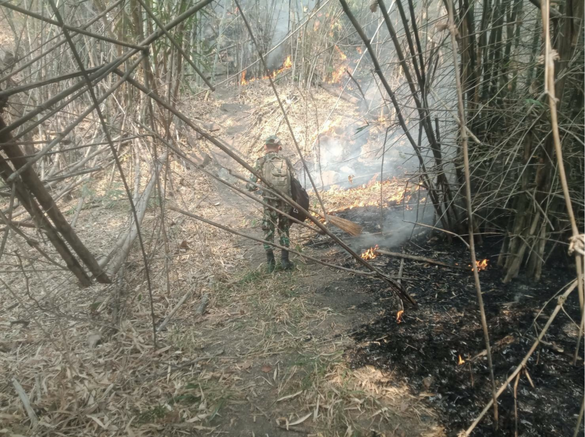
Dr. Nion and the Chiang Rai provincial government have developed the Smoke Watch App which is officially used to monitor and manage forest fires in Chiang Rai. The Smoke Watch App uses data from the SERVIR-Mekong Air Quality Explorer tool. This tool uses satellites to give locations of fires as they happen which enables first responders and forest rangers to go to the exact locations and undertake targeted interventions to put out the fires.
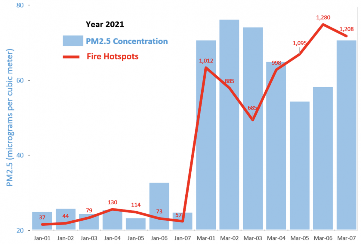
“Previously, it was very difficult and time-consuming for the Forest Fire Department to filter and localize fire hotspots. They would rely on notifications from the community informing them about the exact location of the fires” said Dr. Nion. “Near real-time fire hotspot data from the SERVIR-Mekong Air Quality Explorer tool is instrumental in pinpointing fire hotspots. The faster we identify the fire hotspots, the quicker we can respond to the fires, as a result, less PM 2.5 pollution is released into the atmosphere.”
Dr. Nion has been successful in putting together a multi-stakeholder coalition to tackle forest fires in Chiang Rai, including the government, the private sector, academia and NGO’s - a first of its kind in Thailand. She has also engaged with school children in areas adjoining the forest fire hotspots, teaching them about the impact of forest fires and role of space technology in forest fire detection. The use of SERVIR-Mekong satellite-based data by the Smoke Watch App for locating and managing forest fires has proven successful in Chiang Rai. It helped the authorities overcome the important problem of knowing where the fires are. Managing forest fires, one of the major sources of air pollution, is an important step towards improving air quality in Thailand. Thailand aims to reduce the number of regional fire hotspots by 20 percent in 2021 from the previous year.
Thailand across a larger area; it does not rely solely on localized monitoring stations. This information helps authorities devise data-driven policies and strategies to tackle air pollution in Thailand. The tool has been developed in close collaboration with Thailand’s Pollution Control Department (PCD) and Geo-Informatics and Space Technology Development Agency (GISTDA) – Thailand’s space agency, with the support of USAID. SERVIR-Mekong and PCD will be working with Mekong countries to expand the use of the Air Quality Explorer tool and enhance capacity of those countries to collaboratively tackle transboundary haze issues in the Lower Mekong Region.
SERVIR-Mekong is a joint initiative of USAID and NASA, implemented by the Asian Disaster Preparedness Center (ADPC) that uses publicly available satellite imagery and technologies to address challenges related to water resources, disasters, climate resilience, agriculture and ecosystems in the Lower Mekong.