
GIS & Geospatial Data
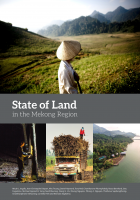
The Mekong region is in the midst of profound social and environmental change. Despite urbanization, the region remains predominantly rural with more than 60 percent of its population living in rural…
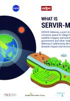
Implemented by the Asian Disaster Preparedness Center (ADPC), SERVIR-Mekong is funded by USAID in partnership with NASA. This infographic card provides an overview of the program.

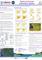
Why this Project?
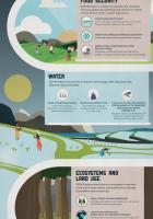
Droughts in the Lower Mekong Region negatively impact ecosystem services, food and water security and biodiversity. These impacts are exacerbated by climate change, further…
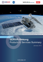
SERVIR-Mekong is a USAID-NASA partnership program designed to improve environmental management and resilience to climate change in the Lower Mekong Region through the increased application of…
Language:
สืบเนื่องจากสภาวะเศรษฐกิจที่เติบโตประกอบกับการเพิ่มขึ้นของจำนวนประชากรอย่างรวดเร็วใน ระเทศตาม ภูมิภาคลุ่มแม่น้ำโขงตอนล่าง ซึ่งประกอบไปด้วย ประเทศไทย กัมพูชา สาธารณรัฐประชาชนลาว เมียนม่าร์ และ…
Language:
SERVIR-Mekong is a USAID-NASA partnership program designed to improve environmental management and resilience to climate change in the Lower Mekong Region through the increased application of…
The SERVIR-Mekong program’s goal is to enhance climate change adaptation and landscape management in the Lower Mekong sub-region. The program aims to achieve this through the increased application of…
Why this Project?
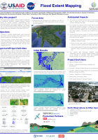
The Lower Mekong Basin is subject to extremes in streamflow conditions, including frequent flooding during the annual monsoon. Understanding and chronicling historic and current…
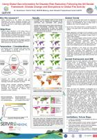
What is SERVIR? This infographic highlights the key objectives and services the SERVIR Hub Network offers.
Multimedia
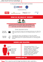
A look at how gender-related issues can be incorporated into Geographic Information Systems (GIS) to support better decision making for climate and disaster risk management and natural resource…
What is SERVIR? This infographic highlights the key objectives and services the SERVIR Hub Network offers.
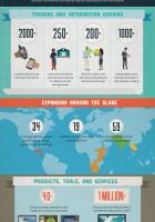
SERVIR By the Numbers Infographic highlights some key figures and achievements made by the SERVIR Hub Network.
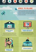
SERVIR in Action Infographic highlights how SERVIR tools and services can help climate and disaster resilience and sustainable development.
Special Reports
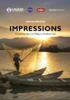
“Impressions” chronicles SERVIR-Mekong's journey from its launch until the present day. The book documents the program's achievements and learnings as SERVIR-Mekong looks to the future—using…
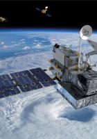
Shedding new light on land subsidence and sea level rise and facilitating flood early warning

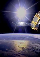
Enhancing our understanding of global weather and climate with precipitation estimates covering much of the planet
Climate change is increasing the frequency and intensity of weather related events…
Language::
SERVIR-Mekong is a USAID-NASA partnership program designed to improve environmental management and resilience to climate change in the Lower Mekong Region through the increased application of…
The SERVIR-Mekong program’s goal is to enhance climate change adaptation and landscape management in the Lower Mekong sub-region. The program aims to achieve this through the increased application of…
Why this Project?
The Lower Mekong Basin is subject to extremes in streamflow conditions, including frequent flooding during the annual monsoon. Understanding and chronicling historic and current…
What is SERVIR? This infographic highlights the key objectives and services the SERVIR Hub Network offers.
SERVIR By the Numbers Infographic highlights some key figures and achievements made by the SERVIR Hub Network.
SERVIR in Action Infographic highlights how SERVIR tools and services can help climate and disaster resilience and sustainable development.
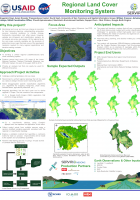
Monitoring land cover and land use change is important for land resource mapping, understanding ecosystem services including resilience to climate change, biodiversity conservation and other issues.…
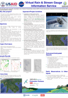
Rain and stream gauge data are sparse in time and space, which hampers decision making on long term planning and development. In addition, river flow data is not widely shared, especially…
Future disruptions to fire activity will threaten ecosystems and human well-being throughout the world, yet there are few fire projections at global scales and almost none from a broad range of…