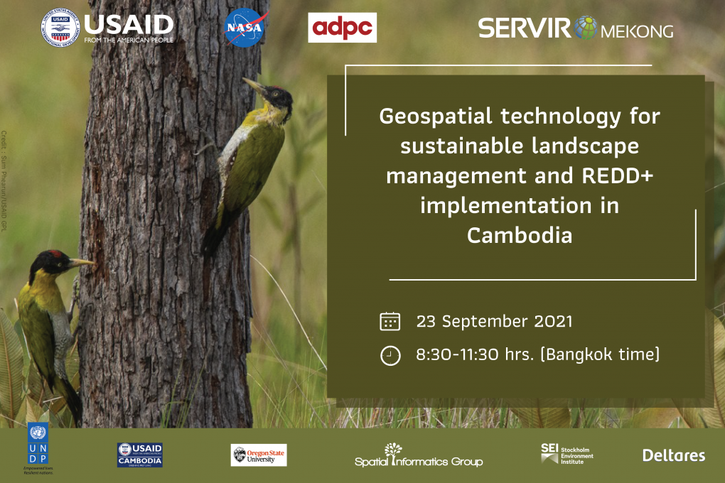
Geospatial technology for sustainable landscape management and REDD+ implementation in Cambodia
Background
In recent years, forest cover loss in Cambodia has been accelerating and is one of the major global contributors to carbon emissions and climate change. Between 2010 and 2016, forest cover in Cambodia has decreased from 57% to 48.14% (Ministry of Environment, 2020). Deforestation and land degradation have negative impacts on the environment, including biodiversity loss and water resource issues. As such, the USAID bilateral mission in Cambodia has been supporting the country in protecting its forests and protected areas through biodiversity conservation and sustainable landscape management.
To support USAID/Cambodia in enhancing forest protection and monitoring for sustainable landscape management and REDD+ projects in Cambodia, SERVIR-Mekong partnered with USAID-Greening Prey Lang (USAID-GPL), Oregon State University, the NASA Applied Science Team (AST). Collaboratively they developed two geospatial tools and associated services.
The Biophysical M&E Dashboard tool was developed to support USAID/Cambodia and other stakeholders to provide insight and reports on the effectiveness of biodiversity and conservation-related project interventions.The SAR alert tool is built within a cloud-based platform, Google Earth Engine (GEE), with a Machine Learning (ML) model using Sentinel-1 Synthetic Aperture Radar (SAR) data which can detect the change in forest on-the-ground at all times and all weather conditions. Both tools and data are open to all users, with an easy interactive interface that can be applied to all levels of stakeholders who work on forest monitoring, REDD+ projects and protected area management, amongst other applications.
Objectives
- To introduce SERVIR-Mekong tools and services, leveraging the opportunity to discuss how geospatial technology and open data can better service local stakeholder needs with regards to forest monitoring and REDD+ activities in Cambodia.
- To take feedback of the wider group of stakeholders on the remaining needs and possible other uses of SERVIR-Mekong’s geospatial technology
Expected Outcomes
- Better understanding of SERVIR-Mekong’s geospatial tools and their application in landscape management and REDD+ project implementation.
- Importance of geospatial technology for local stakeholder engagement in forest monitoring and REDD+ project implementation highlighted.
- Potential opportunities and uptake of SERVIR-Mekong’s tools identified and discussed.
- Geospatial technology and open data for enhancing sustainable landscape management in Cambodia promoted
Registration
Please register here.
Contact Information
Ms Nguyen Hanh Quyen