
GIS & Geospatial Data
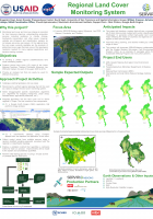
Monitoring land cover and land use change is important for land resource mapping, understanding ecosystem services including resilience to climate change, biodiversity conservation and other issues.…
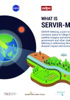
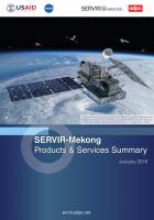
Implemented by the Asian Disaster Preparedness Center (ADPC), SERVIR-Mekong is funded by USAID in partnership with NASA. This infographic card provides an overview of the program.
SERVIR-Mekong is a USAID-NASA partnership program designed to improve environmental management and resilience to climate change in the Lower Mekong Region through the increased application of…
Land Cover / Land Use & Ecosystems
Monitoring land cover and land use change is important for land resource mapping, understanding ecosystem services including resilience to climate change, biodiversity conservation and other issues.…
Implemented by the Asian Disaster Preparedness Center (ADPC), SERVIR-Mekong is funded by USAID in partnership with NASA. This infographic card provides an overview of the program.
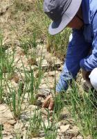
This fact sheet and infographic explains how SERVIR-Mekong's geospatial tool developed in collaboration with Vietnam’s Ministry of Agriculture and Rural Development (MARD) enables agencies under MARD…
Language:
SERVIR-Mekong là chương trình hợp tác của USAID-NASA được xây dựng nhằm cải thiện công tác quản lý môi trường và thích ứng với biến đổi khí hậu tại khu vực hạ lưu sông Mê Kông thông qua việc nâng…
Water Resources & Disasters
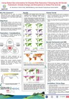
Future disruptions to fire activity will threaten ecosystems and human well-being throughout the world, yet there are few fire projections at global scales and almost none from a broad range of…
Regional
Future disruptions to fire activity will threaten ecosystems and human well-being throughout the world, yet there are few fire projections at global scales and almost none from a broad range of…
Vietnam
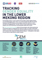
This infographic explains the application of the Gender Equality Monitoring (GEM) platform which has been developed to offer officially published data and periodically updated sex disaggregated data…
This fact sheet and infographic explains how SERVIR-Mekong's geospatial tool developed in collaboration with Vietnam’s Ministry of Agriculture and Rural Development (MARD) enables agencies under MARD…
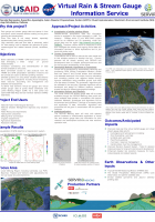
Rain and stream gauge data are sparse in time and space, which hampers decision making on long term planning and development. In addition, river flow data is not widely shared, especially…
Future disruptions to fire activity will threaten ecosystems and human well-being throughout the world, yet there are few fire projections at global scales and almost none from a broad range of…